
Through MapMedia, MaxSea TimeZero Navigator ensures the most complete offer in vector charts thanks to privileged agreements with the best electronic chart data providers such as Navionics.

Pioneer in GPS systems, Navionics launched the very first electronic chart device in the world in 1984, called the Geonav. It quickly became one of the leader in marine cartography, electronic charting and navigation data. Its constant quest for technological innovations has turned Navionics into a reference for data quality and wide electronic chart coverage, very appreciated by sailors and marine professionals all over the world.
Navionics electronic charts can seamlessly cover large areas and allow to zoom down to a resolution of 1 meter (3ft), featuring:
• Tides & Currents
• Port plans
• User-selectable safety depth contour
• Marine services with phone numbers
• Navigation aids with XPlain
• Marsh areas
Navionics provides very comprehensive and frequently updated salt waters, lakes, rivers and marine data, and has achieved remarkable improvements in its latest releases.
Navionics Mega Wide charts now available
Navionics expands its electronic chart offer with the release of several Mega Wide charts:
Africa & Middle East MWVNAF30XGMAP5.1

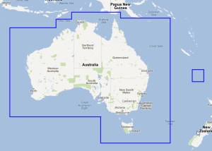
Australia MWVNAU32XGMAP5.1
South China Sea, Korea, Japan MWVNAS35XGMAP5.1

Enhanced quality of marine data
Navionics has collected a wide range of marine depth data through echo soundings in various areas, which profoundly increased the quality of its marine cartography.
See 2 screenshots of the Bahamas area from Navionics and another electronic chart data provider:

Addition of positive values on foreshores
United Kingdom, Ireland and Holland WV28XGMAP1.3

Improved area junctions
Umanai – Greenland – WVNEN21MAP5.1

See all Navionics electronic charts (in vector format) latest releases:
August – United Kingdom, Ireland, Holland & Hamburg Navionics Vector Charts Update
September – Oceania, Europe and Africa Navionics Vector Charts Update
October – Scandinavia, Iceland, Greenland and East Asia Navionics Vector Charts Update
November – Asia, Africa and America Navionics Vector Charts Update
Find all these charts in MaxSea TimeZero charts catalogue.
One thought on “Navionics, pioneer in marine navigation data and electronic charts”