La course Halifax / St-Pierre est une course qui se déroule dans le petit archipel de Saint-Pierre-et-Miquelon sur les côtes canadiennes. La compétition relie la Nouvelle-Écosse jusqu’à la petite île française située juste en dessous de Terre-Neuve, soit une longueur totale de 350 milles.
L’événement s’est déroulé le 26 juin dernier et a rassemblé près de 25 bateaux sur la grille de départ ! Dans la catégorie Class40, Bleu Voile Océanique a terminé en deuxième position avec le navire Bleu35. Une course bouclée en 1j 12h 55min 10s. La compétition fut relativement intense puisque le vainqueur de la traversée est arrivé seulement 40 minutes avant Bleu35.
Andreas Hanakamp is an experienced navigator having started his career by participating in the Olympics in Atlanta in 1996 and Athens in 2004. He competed as a crew member in the Austrian national team. He kept going with international competitions both in-shore and off-shore for several years.
La Clipper Race Round the World est l’une des plus grandes courses nautiques mondiales mais également l’un des défis d’endurance les plus difficiles. Plus de 40 000 milles marins doivent être parcourus durant près d’une année. Le 20 août dernier, douze équipes d’amateurs dirigés par un skipper professionnel, prenaient le départ depuis le port de Liverpool au Royaume-Uni.
Diriger une course d’une telle ampleur est une tâche ardue ! De nombreux paramètres doivent être pris en considération dans le contrôle de la couse. Il faut pouvoir anticiper et examiner toutes les éventualités et appliquer un grand nombre de procédures. Le directeur adjoint de l’édition 2017-2018 de la Clipper Race, Dan Smith nous a accordé une interview où il nous explique son rôle et ses responsabilités au sein de la course.
Guillaume Auger is a TIMEZERO Ambassador and while his career saw him in a variety of domains, some of his prime years has seen him build up a wealth of experience in game fishing! Often having the local knowledge of the best spots means better results but in this interview we see how combining local knowledge with TIMEZERO technology twinned with the right sounder hardware can mean even better results.
Fishing seabream on the coast of Britanny, Guillaume Auger is equipped with TZ Professional v3 and has the additional Sounder and PBG modules. Getting info from two separate sounders: Furuno DFF1-UHD and Airmar B265, TIMEZERO can display the data received of the bathymetry as well as the sedimentary type.
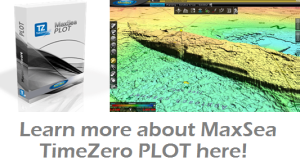
MaxSea distributor Radio Electronic CC is located in Namibia and tells us about a recent installation of the commercial fishing software MaxSea TimeZero PLOT on one of Namibia’s Fisheries Patrol vessels, AK Mungunda.
Walvis Bay, Namibia
The vessel, “Anna Kakurukaze Mungunda”, is one of two Namibian Fisheries patrol vessels, based in Walvis Bay, Namibia:
Namibian Fisheries Patrol vessel, the “Anna Kakurukaze Mungunda”
She was built in 2003, is 59m in length and has a gross tonnage of 1413t.
As two of the Namibian Research vessels are already outfitted with MaxSea TimeZero installations, it was a logical choice to have the same type of system installed on this patrol vessel – for ease of sharing user data, such as PBG bathymetric data, among each other.
Leon Schulz is a MaxSea partner and is a RYA Yachtmaster Ocean instructor. This week, he tells us about his unforgettable experience, navigating his yacht, the Regina Laska to one of the lochs in Scotland, Loch Scavaig in the Isle of Skye, Scotland.
Arriving at Loch Scavaig brings a feeling of a total immersion in nature. Cautiously approaching the narrow harbour entrance, I like to compare the notes in the Imray Pilot Book “Skye and North West Scotland” with MaxSea navigation charts. Both the Navionics, Jeppesen and raster charts in MaxSea provide similar chart data and are very helpful.
Loch Scavaig, Isle of Skye, Scotland
My observation at the harbour entrance, however, is that the water depth is slightly less than is claimed in all the available books and charts, and so, boaters should expect water depths of about 1-1.5 m more shallow than charts indicate, not only during low tide.
When you arrive at the lagoon, you will be greeted by innumerable seals resting on the soft ground rock or curiously peeping out of the water. So we stare at each other and are enchanted by the contact between humans and animals.
The silence of the mountains lying around is only interrupted by one sound – the noise of a waterfall, where the water seems to spring out of the fog into which bore into the mountains. Angelic water?
Slowly, carefully, and with the support of the Furuno NavNet 3D plotter, integrated with MaxSea TimeZero Explorer, we continue into the lagoon. There is no other boat in the area, not a soul. Even our mobile phone doesn’t have reception – no contact with the outside world. Only a small cabin with closed window shutters in the colors of the Scottish flag testifies to the fact that sometimes people here have to seek shelter when the weather becomes too harsh, as is the reputation of Scotland.
The dramatic scenery is breathtaking and so we put our dingy into the water and row ashore. Trails meander along lakes and high up into the mountains with a beautiful view over half Scotland, if not over half of the world. Time and space seem to merge.
My charter guests who have travelled with me all the way from Canada on my HR 46 Regina Laska boat, are full of happiness.
In the evening another yacht arrives in the area and anchors next to us. An aluminum yacht that looks as if it has come from as far as Greenland, Svalbard or Antarctica.
We happily sleep in this paradise, until we are awakened the next morning by a motor noise: A tour boat from the nearby mainland. And then another one. And later another. There are lots of hikers who have stopped here for a couple of hours, to see the same beauty that we had enjoyed in our loneliness the night before. But would they experience the same as us?
Yes, we think, and enjoy the morning coffee while in the sunlit cockpit.
No heaven can be kept for you alone! “Paradise is a state of mind,” said my charter guest. How true! We recognise that my favorite anchorage is no longer a secret. But as long as we believe it, we could feel unique and special in this world.
With this in mind, we drop anchor and sail instead of continuing to the nearby Talisker distillery.
Leon Schulz’s yacht, the Regina Laska is available for charter. Learn more about his services on the Regina Sailing website.
Experienced sailors often say that mooring is the most difficult part of sailing. This week, MaxSea partner Leon Schulz talks to us about how to anchor a boat, using MaxSea TimeZero.
Understand the sea-floor. Navigate around the anchorage area many times. This is done to record bathymetric information so you know what kind of sea-floor you’re dealing with. To record this data, I use my MaxSea TimeZero PLOT, integrated with a Furuno BBDS1 Sounder.
The BBDS1 sounder collects and sends bottom classification data to MaxSea TimeZero software. I can also share this new data-rich bathy chart with the integrated Furuno NavNet TZtouch system. Sand or clay is best for anchoring.
Check tidal range by displaying tidal data in MaxSea TimeZero. This is a really important step to know how much your boat will be raised or lowered by the tide, or vice versa.
You don’t want the boat’s keel to hit the ground during the night, just because the water has disappeared from under the boat. You must also avoid having the boat’s anchor break loose because the boat is suddenly 3 or more meters higher water than when it arrived!
Calculate your desired minimum depth based on my boat’s draught + safety distance under the keel + allowance for tidal changes. Try to find a spot where the boat can swing freely in all directions according to changes in the wind or the tidal current.
Take a last look at the Furuno BBDS1 sounder to check the depth and soil conditions and to see if the boat is in the tidal flow or in an area of strong wind and bring the boat to a complete standstill.
Lower your anchor slowly until it reaches the ground. You can check the markings on the chain or just listen to how the anchor runs more smoothly when it has reached the bottom.
Give the signal to the helmsman to reverse the boat slowly while letting out the chain. At a ratio of 1:4 to 1:5 (from the highest tides expected), stop the windlass.
Wait until the anchor sets and the boat turns into the wind. Then it’s time to stretch the chain by reversing the gear carefully. Do so cautiously, so that there is no residue in the chain.
Once the engine is stopped, set the snubber. This is the piece of rope that is hung with a claw hook into the chain and relieved with the help of a jerk. This also makes the disturbing noise disappear from the chain rubbing against the bow roller.
In windy conditions, put a mooring sail aft, so the bow always points into the wind.
The advantage of MaxSea TimeZero is that you can so easily switch charts. So I often use raster maps at anchor, because there is a lot more information that are interesting for the anchors located. For example, the underwater cable at Iona (see image below).
Anchoring the boat off Iona, Scotland
Even small anchors are located on the raster maps. In comparison, the vector charts give less information about the anchorage.
Now it’s done, you can sleep soundly, even if the wind should freshen up in the night or the wind direction changes.
Leon Schulz is a MaxSea partner and is a RYA Yachtmaster Ocean instructor. His yacht, the Regina Laska is also available for charter. Learn more about his services on the Regina Sailing website.
MaxSea is proud to be a partner of The Ashram Fishing Team. This Australian-based team recently participated in the “Seasport Charters Marlin Cup,” using MaxSea TimeZero PLOT on board. Here is their account of how the tournament went.
The team is made up of Sangeeta Menon, Andy Ziepe, Mark Jarrett and Rhyss Whittred. The Seasport Charters Marlin Cup was hosted by the Perth Game Fishing Club in Jurien Bay, and ran from February 20-23rd.
Jurien Bay is approx. 400km north of Team Ashram’s home port and boasts some excellent game fishing species. The winner of this tournament receives an invite to compete in the Offshore World Championships in Costa Rica for 2015.
Rhyss Whittred gives us his account of the tournament:
“For our team this was the first major tournament we had competed in since I purchased my Wellcraft 270 and revamped the electronics to include Maxsea TimeZero PLOT and Furuno’s latest technology. I can’t say how keen we were to compete and in fact one of the teams there had the reigning world champion angler on board Valkoista (Craig White).
It was a 3 day tournament with your 2 best days fishing score counting towards overall championship points. The night before the tournament commenced I downloaded the latest Maxsea weather file and carefully worked out our fishing plan in line with sea surface temp, currents and plankton.
We headed out and had a cracker of a day. The Maxsea oceanic data was spot on and my team was fantastic with their art of angling and we managed Southern Blue Fin, Striped and Yellowfin Tuna to give us some great points of 2,850 points and our nearest competitors were on 375 points.
Saturday dawned and I planned to go to the same area north where we had done so well the day before. Alas, the water temperature was down 2 degrees, with no bait and no birds. We could hear others on the radio with great fishing results. Unfortunately I had left my mobile phone at the hotel and couldn’t download a current weather file. We were now at a complete low and did not turn a reel for the day.
The next morning I was up very early and downloaded the weather file and made a plan of attack. In fact the good water and temperature breaks we had 2 days before where now 40kms south of Jurien and we needed to get among it. With the early start we got down there in time for lines in at 6am and once again we tagged our limit of tuna and returned to port.
The scoring by other teams was very good and it was an absolute pleasure to have revealed that the Ashram Team picked up Champion Boat, Champion Female Angler, Runner Up Male Angler and Champion Tag and Release.
So my friends at Maxsea, I thank you all for your cutting edge technology and how it all worked in so well with my Furuno equipment and helping us to win this tournament.”
– Rhyss Whittred
Thanks Rhys! And best of luck for the World Marlin Championships in Costa Rica!
Since 1975, the passionate couple Joëlle and Janusz Kurbiel, who has a doctorate in climatology from the prestigious French University the Sorbonne, have dedicated their lives to the exploration of the North Pole. For the last few years, they have navigated through this region with the help of MaxSea TimeZero Navigator, their marine navigation software.
Here is a description of the advances they have made in climatology research onboard the Vagabond’elle and the Marguerite 1 vessels:
Studies/Research Climatology (Dr. Janusz Kurbiel) Our 2005-2010 expeditions were dedicated to the study of ice conditions in the Knud Rasmussen Land, the most unreachable part of the eastern coast of Greenland. The results allowed us to identify the various factors that affect the melting of sea ice and establish the process in this part of the world.
The question is whether this process is identical or not in other parts of the Arctic. Only systematic studies in the field over periods of time will enable the better understanding of the mechanisms governing ice melting in these areas. As preliminary results in 2011 seemed to confirm those of previous expeditions, we decided to expand it to other maritime areas of the Arctic in 2012. The results are being evaluated.
Data acquisition (Dr. Janusz Kurbiel)
Despite the evolution of polar teledetection, field work is still indispensable. Our role is to
collect data about the climatic environment of an Arctic maritime area lying between Greenland and Alaska.
Environmental Arctic study (Prof. Maria Olech) We continued to study the level of pollution of the Arctic and its possible impact on global climate change. More than 700 samples of lichens and mosses were collected, catalogued and preserved for future analysis. Lichens and mosses retain heavy metals and other pollutants in the air. Unlike other plants, they do not grow from the soil, so are considered excellent bio indicators of climate change.
This analysis will determine the degree and nature of the pollution present in the study area and will help assess which changes in the global climate can be attributed to natural changes and which are due to human activity.
We will keep you posted about the results of these studies and adventures in the North Pole!
This is part of a series of short chronicles sent by MaxSea staff from different locations worldwide.
This slideshow requires JavaScript.
Navotas is a city that occupies a narrow strip of land along the eastern shores of Manila Bay in Metro Manila, better known as the “Fishing Capital of the Philippines”.
MaxSea sales representative Dinh went there to meet fisherman from Frabelle Fishing Corporation*, a world-class Philippine deep sea fishing company to present MaxSea TimeZero PLOT, our best solution for commercial fishing.
First, the company started by trawl fishing and then moved into purse seining. Target species were small pelagic fish like sardines, mackerel, and scads within the Philippine waters. In the mid-70s, Frabelle also started the purse seining of tuna and expanded its fishing operations beyond the Philippines into the waters of the Western and Central Pacific region.
Today, Frabelle supplies fresh, frozen and processed seafood products to the Philippine domestic market and exports the same to Africa, the Middle East, North America, Europe and other parts of Asia. Other business areas that Frabelle has ventured into includes: Marl culture; Aquaculture; Post Harvest Facilities and Services; Engineering services; Ship Repair and Shipbuilding; Real Estate and Food Trading and Processing.
Frabelle’s Master fishermen are always looking for new equipment to increase their efficiency. So, naturally, when Dinh introduced them MaxSea TimeZero PLOT, they were convinced that our software could be a very helpful tool for navigation and deep-sea fishing. Right away, Frabelle decided to equip 13 of their biggest purse seiners with MaxSea, mostly operating in Papua New Guinea. After Y&L Fishing, RD Fishing, another big actor in the Filipino fishing industry chose MaxSea!
*Founded in Navotas, Frabelle has more than 40 years of deep sea fishing experience. The vertical and horizontal growth of its fishing operations has made Frabelle Group of Companies one of the most recognized company in both the fishing and food processing industries.


 17 Fourteenth Road, Po Box 670, Walvis Bay, Namibia
 +264 64207483


 “For our team this was the first major tournament we had competed in since I purchased my Wellcraft 270 and revamped the electronics to include
 Our 2005-2010 expeditions were dedicated to the study of ice conditions in the Knud Rasmussen Land, the most unreachable part of the eastern coast of Greenland. The results allowed us to identify the various factors that affect the melting of sea ice and establish the process in this part of the world.
 We continued to study the level of pollution of the Arctic and its possible impact on global climate change. More than 700 samples of lichens and mosses were collected, catalogued and preserved for future analysis. Lichens and mosses retain heavy metals and other pollutants in the air. Unlike other plants, they do not grow from the soil, so are considered excellent bio indicators of climate change.
 First, the company started by trawl fishing and then moved into purse seining. Target species were small pelagic fish like sardines, mackerel, and scads within the Philippine waters. In the mid-70s, Frabelle also started the purse seining of tuna and expanded its fishing operations beyond the Philippines into the waters of the Western and Central Pacific region.
 Frabelle’s Master fishermen are always looking for new equipment to increase their efficiency. So, naturally, when Dinh introduced them MaxSea TimeZero PLOT, they were convinced that our software could be a very helpful tool for navigation and deep-sea fishing. Right away, Frabelle decided to equip 13 of their biggest purse seiners with MaxSea, mostly operating in Papua New Guinea. After Y&L Fishing, RD Fishing, another big actor in the Filipino fishing industry chose MaxSea!