What Is the Best Marine Navigation App for iOS?

Navigating on the water has never been easier, thanks to the growing number of marine navigation apps available for iOS. Whether you’re a weekend boater, a coastal cruiser, or a serious angler, having a reliable app on your iPhone or iPad can help you avoid hazards, plan smarter routes, and enjoy your time on the water with confidence.

But with so many options, which app is truly the best for iOS users in 2026?

Let’s take a look at the top contenders and the features that matter most—culminating in our recommendation for the most complete and powerful boating app available today.

What Boaters Want in a Navigation App

Before diving into the apps, here are the key features boaters consistently look for:

  • Accurate and up-to-date charts
  • Offline access to maps and weather
  • AIS and radar overlays
  • Smart route planning
  • Anchor alarms and safety alerts
  • Weather forecasts and tide data
  • Integration with onboard systems
  • Ease of use on mobile devices
A person holding a smartphone displaying a marine navigation app, with a boat moored in the background on calm water during sunset.

Top Marine Navigation Apps for iOS

🥇 TZ iBoat – Best Overall for iOS

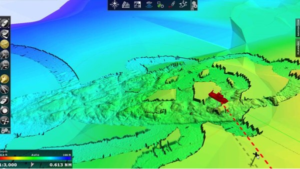
TZ iBoat stands out as the most complete marine navigation app for iOS. Designed by TIMEZERO, TZ iBoat offers high-resolution raster and vector charts, satellite imagery, and bathymetric data through its TZ MAPS subscription. This subscription unlocks access to the latest chart updates and advanced visual layers, making it a powerful tool for both recreational and professional mariners.

Why TZ iBoat is the best:

  • TZ MAPS: A single subscription offers access to raster, vector, satellite, and bathymetric charts
  • Dynamic Moorings: Smart anchoring suggestions based on wind and protection
  • AIS & Radar: Compatible with Furuno hardware and NMEA systems
  • Optional Advanced Weather Models: Includes GFS, ICON, AROME, and more
  • Offline Access: Charts and weather available without internet
  • Customizable Interface: Choose from multiple chart styles and overlays
  • Safety Tools: Anchor alarms, MOB function, programmable alerts

TZ iBoat is ideal for boaters who want a professional-grade app that works seamlessly on iPhone and iPad. It’s especially useful for sailors and anglers who need advanced features without the cost.

Promotional banner for TZ iBoat app highlighting a 7-day free trial, featuring a blue background with topographic map elements, and showcasing app screenshots with nautical charts.

🥈 Navionics – Great Chart Coverage

Navionics is a long-time favorite among boaters. It offers detailed vector charts, auto-routing, and community-sourced updates. It’s a good choice for users who want reliable charting and weather data.

Pros

  • Good global chart coverage
  • Auto-routing and SonarChart features
  • ActiveCaptain community integration

Cons

  • Some users report UI issues and crashes
  • Price

🥉 Savvy Navvy – Modern and User-Friendly

Savvy Navvy is a newer app with a user-friendly design and smart routing features. It’s built with sailors in mind and includes wind and tide overlays.

Pros

  • Intuitive interface
  • Wind and tide-aware routing
  • Clear charts

Cons

  • Charts may lack fine detail in some areas
  • Missing the advanced features of other apps

Conclusion: TZ iBoat is the Best Marine Navigation App for iOS in 2026

If you’re looking for the most complete, reliable, and feature-rich marine navigation app for iOS, TZ iBoat is the clear winner. It offers everything boaters, sailors, and fishermen need, from high-quality charts and weather data to advanced features. While TZ MAPS requires a subscription, the value it delivers, especially when paired with optional modules and Furuno compatibility, makes it a top-tier choice for serious navigation.

Whether you’re navigating coastal waters, enjoying a day of sport fishing, or planning your next sailing trip, TZ iBoat offers everything you need to stay safe, informed, and in control.

Try TZ iBoat today and experience the future of marine navigation on your iPhone or iPad.

Promotional banner for TZ iBoat marine navigation app featuring a blue background with the app logo and a testimonial highlighting its ease of use.

Is the Cloud finally reaching the sea?

Cloud technology is exciting and the possibilities surrounding the technology are expanding each day. Will cloud finally reach the sea? Cloud coverage for the marine navigation industry is almost inevitable. It really is just a case of when, not if. TIMEZERO is currently developing a tool that will circumvent pricey satellite internet provider fees.

tz-cloud

Cloud technology would still open up a list of possibilities to marine navigation software. Let’s take a look at some of these!

uk_flag Read more france_flag Lire l’annonce

TZ Navigator v3 Video Sneak Peek

TZ Navigator is now officially set for release: May 19th, 2016.

In this video you will see all the new features in action:

Click to watch the video

TZ Navigator v3 play video

New User Interface

Our redesigned user interface will make your life much easier when it comes to route planning and all the features you are familiar with (Tides, Currents, Weather Forecast, etc.). All the concepts which made TIMEZERO a huge success (Tool Bar, Layers and Navdata) are now included in an enhanced User Interface fully adapted to be used on touch screens!

Security Cone

The new Security Cone is a feature in adherence with the official rules of the IMO. It uses the data in vector charts or the 3D data within the charts to detect shallow areas and isolated dangers. If an obstacle is detected inside this cone in front of the boat’s trajectory, an anti-grounding alarm will automatically be triggered.

Secure Route Planning

Route Planning is of the utmost importance for every boater. Our new technology assures the security of a route upon creation. Through color codes (green/red) it is instantaneously possible to know if the depth is sufficient for the safe passing of your boat.

And more!

Note: The release of TZ Navigator will mean that we will stop supporting all TIMEZERO v1.9.8 and below. We will continue however to support v2 on all compatible operating systems until the end of 2016 (Windows XP, Windows 7 and Windows 8.1).

TZ Professional v3 Release

We are very pleased to announce the official launch of TZ Professional v3, the biggest TIMEZERO release ever!

TZ Pr

Since its release back in 2007, our range of TIMEZERO products has not stopped evolving, always maintaining the same objective: to provide a product that meets the most demanding needs of professionals at sea. Close to 25,000 vessels currently use our TIMEZERO software. This new version offers an incredible amount of new features specifically designed for both professional fishermen and workboats.

The primary new features designed for professional fishermen are the following:

  • New PBG module offering a resolution level twice as powerful
  • New profile window allowing for instant visualization of seafloor detail
  • New Fishing Workspace allowing for customized shading and contour lines
  • New redesigned 3D Workspace (“3D Cube”)

The primary new features designed specifically for workboats are the following:

  • Compatible with S57 NOAA Charts and official S63 ENC Charts
  • New advanced route management (checks depth and obstacles inside the XTE of the planned route)
  • New AIS features (receiving and sending “normal” and “safety” AIS messages from within the software)

Access the complete list of new features and enhancements (PDF):

 download overview

 If you have any questions, then please don’t hesitate to get into contact.

Rest of World Jeppesen Vector Chart Updates

We are pleased to announce that the following ROW Jeppesen charts for TimeZero software have been published by MapMedia and are available in our chart catalog for purchase as of May 27th.


Examples of before and after chart areas

GULF OF THAILAND TO YELLOW SEA – MWVJASM001MAP8.1

GULF OF THAILAND TO YELLOW SEA - MWVJASM001MAP8.1

BAYKAL AND SIBERIAN LAKES – WVJRSM217MAP8.1

BAYKAL AND SIBERIAN LAKES Jeppesen chart
You can find more old versus new chart examples in our Facebook and Google+ albums.

Updated Information

These updates include the latest charts and NTM provided by our data providers.The following chart versions are now available:

Jeppesen ROW Chart update

Feel free to contact us if you need any further information, by sending an email to info@maxsea.fr.


5 Tips for Choosing the Best Nautical Chart

Version 2 of the MaxSea TimeZero App Features AIS and Radar Compatibility!

We are very excited to announce the release of a new version of the MaxSea TimeZero App for iPad: v2.0.0! This updated version includes lots of useful new features, designed to make boating easier, safer and more enjoyable.

Release of v2.0.0
Here is a summary of the most important new features:

  • Free chart updates

If you already own a chart zones for the MaxSea TimeZero App in any previous version of the App, you can take advantage of free-of-charge chart updates! This one-time free chart update is offered to all of our valued customers that purchased any chart zones in version 1. Whatever chart area(s) you previously owned will be updated once you install V2 of the MaxSea TimeZero App.

  • AIS compatibility

The MaxSea TimeZero App can now integrate AIS data, as long as you add on the “AIS Module” which is an In-App purchase. This module allows you to connect any NMEA 0183 AIS receiver through the Wireless Network, and display AIS targets on the App’s charts.

Detailed AIS target information is available by touching any target on your screen. This displays Name, MMSI, CPA, TCPA, Vessel Type, Size, etc.

AIS Module Price: 8,99€

MaxSea TimeZero App: AIS compatibility

  • External instrument connections (NMEA)

Now it is possible to use external instruments that have been connected to a NMEA 0183 WiFi multiplexer through the Wireless Network. The Maxsea TimeZero App can now display additional data such as Depth, Heading, Sea Surface Temperature and use a dedicated external GPS.

  • Share feature

The Maxsea TimeZero App for iPad has launched a new (Beta) service that lets users share their position with friends and in turn, see their friends’ positions on their chart.
Positions are only shared after an invitation has been sent and accepted. You can manage your friends directly from the app or from the dedicated website.

Your position can be viewed on devices other than an iPad. In this case, the friend must create a My TimeZero account. The user then shares their position with this account, which can be viewed as a regular web page.

  • FURUNO DRS4W Radar compatibility

Now you can integrate the MaxSea TimeZero App with the FURUNO 1st Watch Radar! To do so, the Radar Module must be added as an In-App purchase. This module allows you to connect the FURUNO 1st Watch Wireless Radar to the MaxSea App.

You can then overlay the radar image across the navigation chart in the MaxSea TimeZero App, ensuring heightened security onboard.

Radar Module Price: 49,99€

MaxSea TimeZero App: Radar compatibility


Download the MaxSea TimeZero App v2.0.0

NOAA Raster and Vector Chart Updates for the USA are Available Now!

These US charts have been updated and are available as of March 17th, 2015 in our Chart Catalogue:

MaxSea NOAA Chart Update List

The following NOAA chart versions are now available:

  • VECTOR – MWVSUSAMAP9.1 NOAA Vector Charts & USACE Inland Charts
US_NOAA_charts_coverage

Updated Information

  • Updated NOAA Vector Charts (S57): This Edition adds 70 new Vector Charts to the library as well as many other chart updates.
  • Updated NOAA Raster Charts: This new edition includes the latest chart updates that can be found on the NOAA paper charts.

Read full information about these chart updates in this PDF file.

Clickforexamples

NOAA charts are totally free of charge and you can download them through our Chart Catalog, to make sure that you’re using the most up-to-date chart data available for US waters.

Watch our new video - 5 Interesting Facts about Nautical Charts

Annual Awards Ceremony at the Perth Game Fishing Club

The Perth Game Fishing Club, based in Fremantle, Western Australia had its annual awards ceremony on October 18th. MaxSea is a proud sponsor of the club and our Regional Sales Manager Thibault Hua attended the event. 

The awards were held at the recently-refurbished Fremantle Sailing Club function room, overlooking the marina and Indian Ocean with truly stunningly beautiful views.

Fremantle sailing club
Fremantle Sailing Club

Thibault was hosted by President Ben Weston, Vice President Tim Carson and Rhyss Whittred – life member, whose boat has a full suite of electronics that include MaxSea and Furuno, and was one of the big winners in the awards.

Members of the Club got to spend time with Thibault and trade tips on sport fishing.

Award Winners

Rhyss’s vessel “Ashram” has already been featured on our blog after qualifying for the 2015 world championships in Costa Rica. He didn’t let his team of anglers down with some impressive awards:

  • Champion Boat – Ashram
  • Champion Male Angler – Rhyss Whittred
  • Champion Female – Sangeeta Menon
  • Champion Junior – Drew Ziepe
  • Most species tagged and released – Sangeeta Menon
  • Most fish tagged and released – Rhyss Whittred

2014_PGFC_Presentation_s-100
Thibault Hua, MaxSea RSM, with winners at the awards ceremony

Rhyss Whittred, Sales Manager WA, SA & NT at Taylor Marine

PGFC enjoys a continued relationship with MaxSea, and has witnessed the increase of club members using MaxSea TimeZero PLOT software. The majority of the awards on the night went to boats running MaxSea software.

.

Find a reseller - MaxSea TimeZero PLOT

MaxSea at IceFish – the Icelandic Commercial Fishing Show

Last week, Regional Sales Manager Thibault Hua represented MaxSea at the IceFish exhibition which took place in Reykjavik. IceFish is the must-visit event of the commercial fishing industry. Here he tells us how it went.

MaxSea products were displayed at the stand of Iceland’s Furuno distributor Brimrún. Special emphasis was placed  on our PC-radar and fishing-PC sounder solutions with Furuno sensor integration. The new WASSP interface was also very successful because of the increase in productivity and time it represents for bottom mapping tasks.

WASSP - MaxSea integration
WASSP – MaxSea integration

Learn more about the new WASSP-MaxSea compatibility!

MaxSea and Brimrun Representatives
MaxSea and Brimrún Representatives

Brimrún has been the exclusive MaxSea distributor in Iceland for the last 3 years, and is highly-knowlegable on our software. Their input has always been priceless to the improvement of our products. Brimrún spends time training customers on how to use MaxSea. They have organised several training seminars and more are planned for the future. Get in touch with Brimrún to learn more.

Iceland boat show3

Iceland boat show2

Thibault would like to thank them for their support over the past years and for their welcome during the show.


Visit Brimrún’s website or send them an email if you would like to know more about this Icelandic distributor of MaxSea.


Find a reseller - MaxSea TimeZero PLOT

The MaxSea-WASSP Seminar in Barcelona

Last week, MaxSea and ENL (Electronic Navigation Limited) co-hosted a training seminar event in Barcelona. Over 46 distributors and partners attended from 21 different countries around the world in order to learn more about MaxSea TimeZero software and the WASSP multi-beam sounders.

Dates: August 26th – 30th, 2014

Speakers: Iker Pryszo (MaxSea), Phil Seyb and Nick Fogarty (ENL)

Programme:

MaxSea-WASSP seminar

The Classroom Training

The Group Sales Manager at MaxSea, Frédéric Algalarrondo gave an introductory speech, welcoming all the particpants to Barcelona, and explained the schedule of the week.

Iker Pryszo then spent one day giving a technical training session on TimeZero Coastal Monitoring, a turnkey surveillance system that can be configured for a range of commercial applications, such as for ports, harbors or oil rigs.

On the second day, Iker presented MaxSea TimeZero PLOT, which is designed for commercial fishing and can now be integrated with WASSP multi-beam sounders, resulting in an extremely effective and powerful fishing aid. The MaxSea WASSP Module is required for this software-hardware integration.

The third day of classroom training was a techical training on the WASSP multi-beam sounders, presented by Phil Seyb and Nick Fogarty.

MaxSea

The Welcome Dinner

After the first day of training, all the seminar attendees plus the MaxSea Naval staff enjoyed a dinner together. Some people stayed out later than they should have, but the details of this night are highly confidential and cannot be publicly disclosed…

MaxSea-WASSP Seminar Dinner
This was only the beginning…

Onboard Training

The last part of this seminar took place on the MaxSea boat. Attendees were invited to board at the Barcelona marina and see the installation of WASSP multi-beam sounder integrated with MaxSea TimeZero PLOT in action.

MaxSea WASSP onboard training
Seminar attendees

The MaxSea WASSP onboard training
The view from the boat!

Brice Pryszo, CEO and President of MaxSea

The MaxSea Naval staff

You can view more photos from the onboard training in this MaxSea Facebook album.

We would like to thank everyone for coming to the seminar, and it was a pleasure to meet so many distributors and partners and have the opportunity to have an enjoyable and informative week together.


If you would like to learn more about the products featured in this seminar, please use the below contact details:

MaxSea TimeZero PLOT: info@maxsea.fr

TimeZero Coastal Monitoring: info@tzcoastalmonitoring.com

WASSP Multi-Beam Sounders: Fill out this contact form


Find a reseller - MaxSea TimeZero PLOT